How remote monitoring helped prevent casualties in a bridge collapse in Johor, Malaysia
Challenge
Iskandar Puteri is the administrative capital of the state of Johor in Malaysia. Located on the border with Singapore, the city is home to famous landmarks, making it an attractive destination for a multitude of visitors. The city features several bridges, including one that connects Forest City to the Tanjung Pelepas highway.
This bridge spans a total length of 78 meters and plays a vital role in regulating traffic to the city. With a significant and continually increasing volume of traffic, it is essential to monitor not only the stability and structure of the infrastructure but also the condition of the surrounding soil.
Solution
The bridge operator contracted Geolab to oversee the monitoring of the structure. Considering the area’s topography, the height of the columns, and the challenging access to the bridge, the geotechnical company decided to implement remote monitoring.
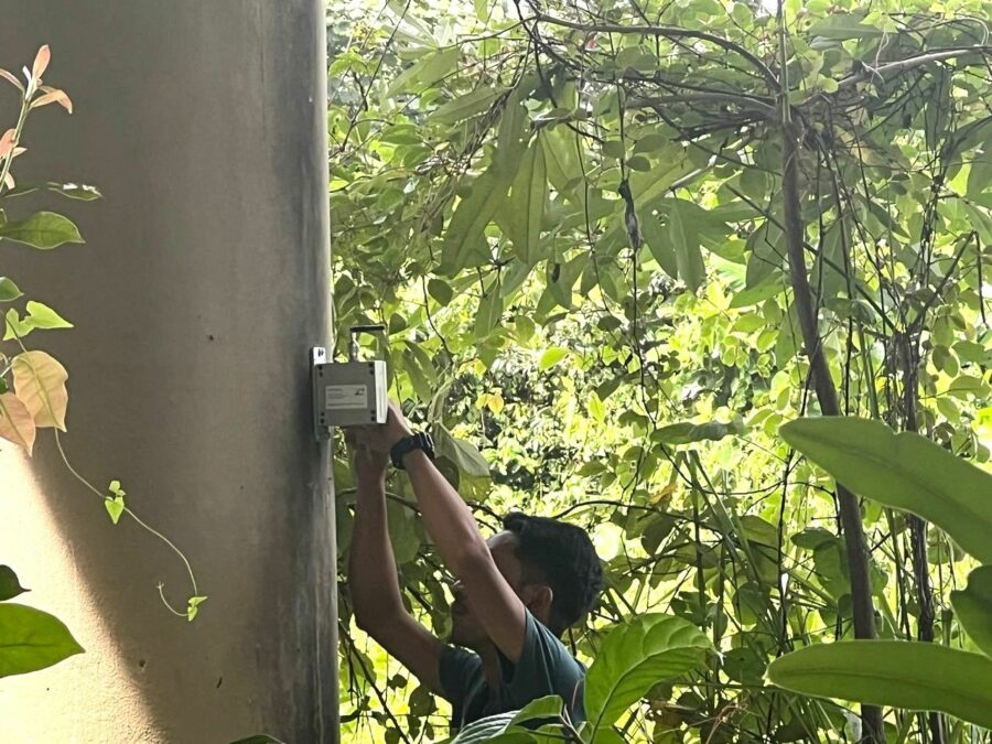
They connected 36 Worldsensing tiltmeters, placing one on each of the bridge’s columns to measure tilt readings.
Tracking the Progress in Preventing a Tragic Event
On July 23rd, the sun rises over Iskandar Puteri and Forest City.
7 am: Two of Worldsensing’s Tiltmeters detect movement on the bridge, triggering an alert that is sent to Geolab’s data visualization software. The company closely monitors the data.
From 7 am to 2 pm: These two devices reveal significant structural movement, while the data from other Tiltmeters remains consistent. The motion is unmistakable. Geolab immediately contacts the bridge operator, necessitating the evacuation of the site and road closure as a safety precaution.
2:09 pm: The operator reaches out to local authorities and the police for assistance.
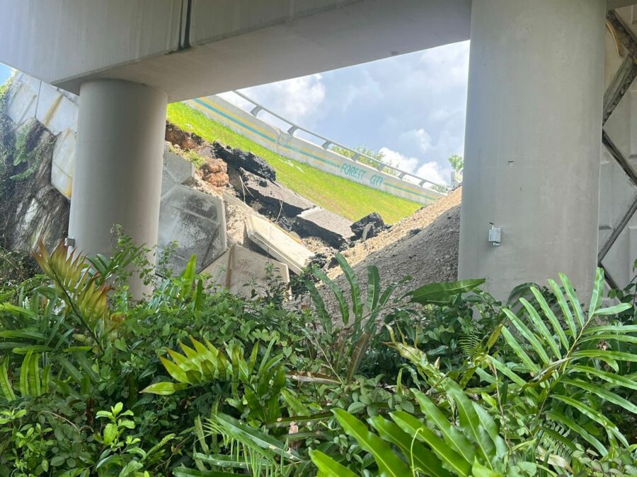
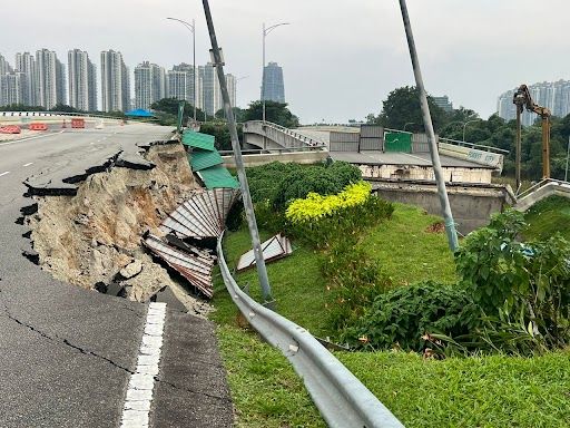
2:15 pm: The police and emergency services swiftly arrive on-site. The road is closed to the public. They confirm what the data indicated: a 25-meter-long section of the road and bridge has collapsed, leading to road closure. The rescue team inspects the area and confirms that there are no reported casualties.
Benefits
The use of the Worldsensing wireless monitoring solution supported collective safety prioritization efforts and enabled learning from past incidents. Geolab, with “their trust in the Worldsensing quality of data” as confirmed by Thein Htun Aung, played a pivotal role in averting a catastrophic event.
Worldsensing solution leverages high-performance, low-power long-range (LoRa) technology, ensuring its capabilities endure for up to +/- 10 years, continuously contributing to site safety. This technology is available to facilitate the tracking of asset maintenance and the monitoring of their integrity.
Remote geotechnical and structural monitoring can supplant manual measurements, offering uninterrupted data for anomaly detection and the prevention of failures, particularly in the case of compromised infrastructure.
Are you planning a project?
Get in touch with us to share your needs and project requirements. We are experts in engineering and IoT and are happy to help.


