Accurate Positioning System

Cost-efficient GNSS monitoring with the precision you need

REQUEST A QUOTE

Deploy multiple systems while minimizing hardware deployment costs.

High-value GNSS systems for multi-point ground movements monitoring. Introducing a high-precision positioning system based on Topcon’s GNSS technology, Worldsensing broadband networks and Bentley’s software platform.

High-value Accurate Positioning System

Unlike traditional GNSS solutions, the Accurate Positioning Systems allows you to deploy monitoring systems with the data quality you need, at a fraction of the cost.

RELY ON FIELD-PROVEN TECHNOLOGY

Leverage top-tier instrumentation, connectivity and software providers, offering proven reliability and exceptional customer support for a seamless deployment experience

MINIMIZE COSTS ON HARDWARE DEPLOYMENT

Take advantage of a disruptive technological solution that drastically reduces the initial investment and deployment times compared to traditional GNSS monitoring.

STREAMLINE YOUR DATA PROCESSING WITH DEDICATED SOFTWARE CONFIGURATIONS

Leverage the readily integration of Topcon’s GNSS devices into Sensemetrics software to easily determine what precision is required and adjust to reach those requirements.

SOLUTION

Topcon's High Precision GNSS Receiver

Leverage the high precision capabilities of Topcon’s AGM-1 GNSS receiver, featuring:

  • Precision up to 3 mm in the horizontal axis, and 7 mm on the vertical axis.
  • Precision dual-frequency GNSS smart antenna
  • Multi-constellation with default support for GPS and GLONASS

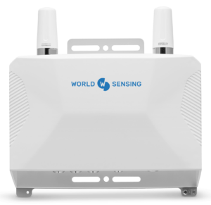
ThreadX3 enabled

Leverage the power our ThreadX3, a fully autonomous connectivity station for robust and continuous monitoring:

  • Plug & Play sensor integration
  • Differential GPS post-processing utilizing local control station(s).
  • Supports operation in distributed applications leveraging solar panels and wireless mesh communications.
  • Process positions at rates varying from 1 hr to 24 hr, supporting varied wake schedules
Discover More

Bentley's centralized software platform

Manage your network deployment from a single software platform, from network to node configuration:

  • User-selected Grid and Datum selections for translation to cartesian coordinates (NEH).
  • Assumes wake schedule of Thread device, allowing for optimization of power settings suitable to the application.
  • Calculates all standard geospatial derivative metrics, including: position, displacement, velocity and acceleration.
  • Provides GNSS specific diagnostics, including: covariance Matrix, dilution of Precision, tracked satellites, epoch count.
Discover more

Areas of Application

Deploy your systems in multiple locations and integrate data for accurate positioning

Slope Stability

Slope stability deals with soil mass stability: an inclined mass of soil needs to withstand its own weight, surcharge, and water conditions, either flow or hydrostatic. Worldsensing’s Accurate Positioning System allows to assess the evolution of ground movements in these ground structures by measuring its displacement both vertical an horizontal.

Settlement Monitoring

An Accurate Positioning System can help you monitor ground structures and the appearance of settlements resulting from heavy loads pressing the ground. By assessing its long term evolution, engineers can take action to protect buildings or other civil infrastructure prone to suffer the effects of these vertical ground movements.

Subsidence and Heave

Assess the evolution of these critical geotechnical phenomena of contracting and expanding soil. Use Worldsensing’s Accurate Positioning System with millimetric precision to take action when these vertical movements can pose a threat to nearby civil infrastructure and buildings.

How it works

An integrated monitoring solution

A seamless data flow from sensors to platform for better data-based decision making.

Monitoring Instrumentation

Connect Topcon’s AGM-1 GNSS receiver to a ThreadX3 in a simple connect-and-collect installation. Half your deployment times compared to similar GNSS projects. Configure your required precision and adjust it according to the project’s needs at every step.

Connectivity Enablers

Rely on ThreadX3, multi-sensor connectivity enables that simplifies the deployment of GNSS monitoring systems. Create a network of different stations under a mesh network for added system redundancy. Process positions at rates varying from 1 hr to 24 hr, supporting varied wake schedules

Software Layer

Work with Worldsensing’s preferred software partner for data processing of your monitoring data. Leverage the readily integration of Topcon’s AGM-1 GNSS receiver to make advanced data processing, and use this data to trigger notifications and other M2M data-driven actions.

Schedule a free discovery session

Sign up for IoT remote monitoring news